Ferrocarril Chihuahua al Pacifico
Officially known as the Q-Line, it gained the somewhat more geographic name Chihuahua al Pacifico and is now simply called the CHEPE. For which ever name you call it, they all stand for one of the most beautiful railroad journeys in the world; a wonder of planning and engineering through the 3,000 meter high mountains of the Sierra Madre.
The Q-Line runs a distance of 673 km from Topolobampo on the Mexican Pacific coast to Chihuahua, the capital of the State of the same name. If one also counts the 268 km to Ojinaga, along the border to the USA, then the entire distance totals to 941 km.
The founders of this important connection through Northern Mexico, Albert Kinsey Owen and Arthur Edward Stilwell are considered two 19th Century visionaries. Owens was an engineer with railroad man drive; he had already participated considerably in the building of the railroad line Laredo - Mexico City. In 1861 he visited the Mexican Pacific coast and became enthusiastic at the delightful natural sea port Topolobampo. This area appeared to him as an ideal terminal for a railroad route over Mexico’s Sierra Madre into the USA. Not only would precious ore and lumber be able to reach the Eastern USA faster; he envisioned import and transport along this route, of goods and merchandise from the Far East to the Pacific coast. So Asia and America would become economically closer.
Arthur Edward Stilware was the son of a wealthy New York family, who for 32 years already owned a railroad company. His plan was to build a link from Kansas City to Presidio, Texas. Here he wanted to cross the Rio Grande in order to create on Mexican side a connection from Ojinaga crosswise through northern Mexico to the Pacific coast and Topolobampo. This railroad line would be several hundred kilometers shorter than the Kansas City - San Francisco route.
The financing seemed secured: In the USA, oil companies and municipalities supported the project; in Mexico the government of President Porfirio Diaz issued land and concessions to rich entrepreneurs. From 1897, when the first spade full of soil was turned, to the Mexican Revolution of 1910, nearly 400 km of the track were laid along the cleared right-of-way. On the east side of the mountains, 295 km from Chihuahua to Creel into the Sierra Madre had been completed. On the other side, outgoing from the Pacific the distance between Topolobampo to San Pedro, about 105 km, were laid. The companies involved were the Chihuahua al Pacifico Railroad Company owned by Enrique Creel as well as Arthur Stilwell’s Kansas City, Mexico & The Orient Company.
The revolution and the following war years stopped further progress over the mountains. Tracks were attacked by rebels and the Mexican government lacked the financial means to advance. Only the distance from Chihuahua to Ojinaga on the Rio Grande would be completed during this time. Not until near the end of World War II did construction proceed. Only after President Lazaro Cardenas nationalized the railroads of Mexico in 1940, would the gap in the Sierra Madre be closed. Over 20 years of construction but on November 22, 1961, it was finally finished: After one century of planning and construction the first railroad from Los Mochis reached the desert city of Chihuahua.
Thus the distance between “Chihuahua al Pacifico“ was complete, but at what cost! For the last section alone (273 km) over 1 billion pesos (equal to over one billion of today’s US Dollars) were invested, which Mexico financed without foreign assistance. Without a doubt the CHEPE – as it is called affectionately by the locals – was and is an important connection for the mountain inhabitants.
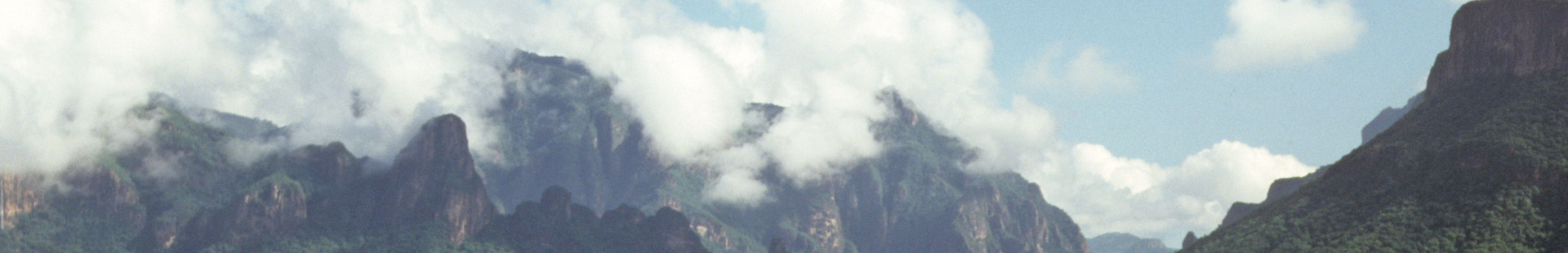
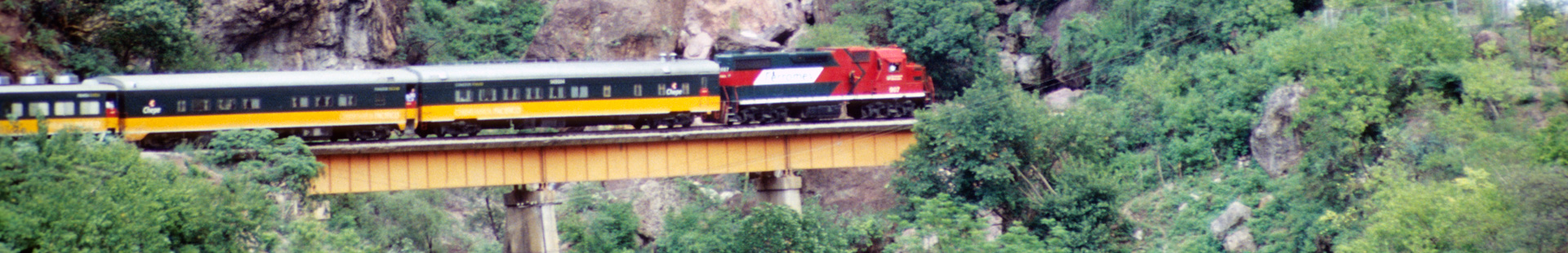
The railroad remains a masterpiece of engineering. With 39 bridges and 86 tunnels, an overlapping loop, everything imaginable became reality. In a few hours the train rises from 20 m to 2,439 m elevation – in curves and upward gradients, none of which exceed 2.5 %. Particularly impressive is the elevation gain between El Fuerte and Temoris. In the Temoris loop the railroad rises in two zigzags (turning 180 degrees inside the mountain) to the height of the Temoris’ Bridal Vale Waterfall. At this historical place in 1961 the construction crews from Chihuahua and Sinaloa met each another. Then at the level of the waterfall, the train enters the “Perla” tunnel to emerge on the other side of the mountain.
During a trip with the CHEPE, you will pass several vegetational and climatic zones:
A kind of savannah forest grows between Los Mochis and El Fuerte. The sparse trees and bushes with cactuses in between are leafless for most of the year. In spring, however, it is these slopes that are adorned by the violet flowers of Tecoma trees and white-bloomed bindweed.
The canyons in the lower part of the Sierra Madre have a subtropical and tropical vegetation. Palms are frequent, and bananas, pineapple, mangos and other fruits flourish very well here.
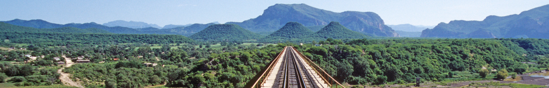
After Temoris, forests dominated by pines and oaks are characteristic. Winter in this region is severe and brings plenty of snow.
East of Cuauhtémoc, wide grassy plains extend down to Chihuahua. They are the centre of agriculture and cattle-raising in the federal state of Chihuahua.
Is the CHEPE an outdated railroad? Of course not! Besides the locals of the Sierra Tarahumara, who depend on it for transportation, ever more travelers, authors and film teams discover and document the attraction of this unique rail travel.
